Maps from the 1960's
Published by Jonny on June 20, 2018
Working in un-mapped parts of the world is a tremendous challenge, but as luck would have it, Uganda has been mapped before… by the British Army in the 1960’s! Even more lucky is that there is a copy of the entire series of maps in the University of Manchester map library…
Thanks to Donna Sherman, our wonderful map librarian, we were able to access the maps so that we can use them in support of our own mapping efforts. Though the extensive displacement of people due to repeated conflict in the area over the >50 years since the maps were made has meant that much of the information is no longer useful, some of it (particularly major roads and place names) are of great value indeed, and so we began the process of seeing what we could do to digitise the information.
Due to the maps being housed in the Special Collections of our library, we could not remove them or run them through a scanner in case something happened to them, so we needed an alternative plan.
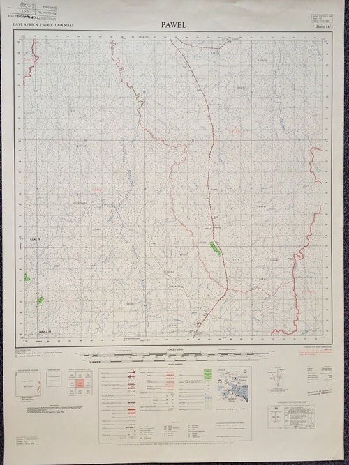
We therefore asked one of the University staff cartographers (who also happens to be an outstanding photographer!) Nick Scarle to photograph the part of the collection that covered our area of interest. This resulted in 144 images looking something like this:
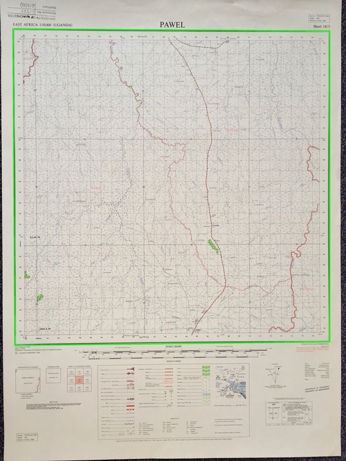
The images were corrected for barrel distortion using ImageMagick and the map frames were automatically detected in the image using the map using OpenCV:
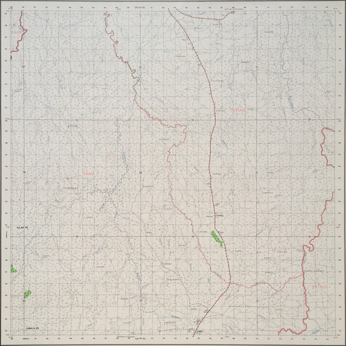
The frames were then extracted and corrected for perspective distortion:
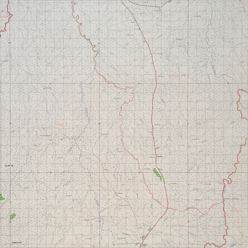
and then cropped to remove the border:
finally, the software uses rastrio to try and colour balnce the images and then GDAL to georeference the extracted images, mosaic them into a VRT and then cut the result into tiles to be served to a leaflet map:
Not bad eh! If you want to see the code, you can clone it from the GitHub repo.